.jpg)
RiskAI Blast
Smarter Blasting with AI Precision
RiskAI Blast is a real-time data-driven platform designed to predict ground vibrations and recommend optimised blast design for an efficient drive/blast without having to worry about exceeding vibration set thresholds.
Using advanced AI algorithms, RiskAI Blast makes rock blasting safer, faster, and significantly more cost-effective.
.jpg)
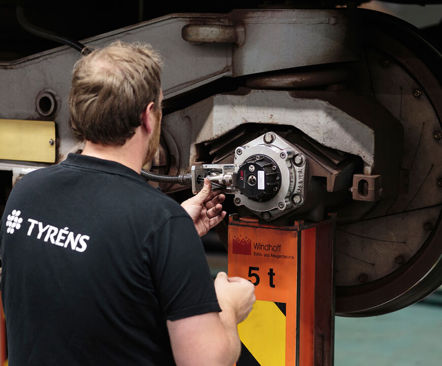
The cost of inaccuracy: why empirical blast design is no longer enough.
Blasting in urban or infrastructure-heavy environments comes with high risks of damage. Traditional methods rely heavily on human expertise and conservative empirical methods—often resulting in overbreaks, underblasting, inconsistent ground vibrations, or costly damage to nearby structures. The industry struggles with:
- Empirical methods used today lacks accuracy and are unreliable.
- Inconsistent blast designs, often dependent on individual experience and sometimes trial and error rather than data-driven optimization.
- Lack of accountability for bad blast practices, rock often gets the blame.
- Current system used today are complex to use for less experienced users.
- Loss of expert knowledge, as senior professionals retire without structured knowledge transfer.
- Resistance to innovation, with many projects still relying on outdated, manual methods.
- High environmental and financial costs, including unnecessary carbon footprints and prolonged project durations.
As cities densify and infrastructure demands grow, there’s an urgent need for tools that ensure precision, reduce waste, and accelerate execution while maintaining safety and compliance.
"RiskAI Blast is a game changer. It helped us reduce overbreak while giving us full control over design updates and risk management."
- Site Engineer, Slussen Project
RiskAI delivers precision and real-time risk control.
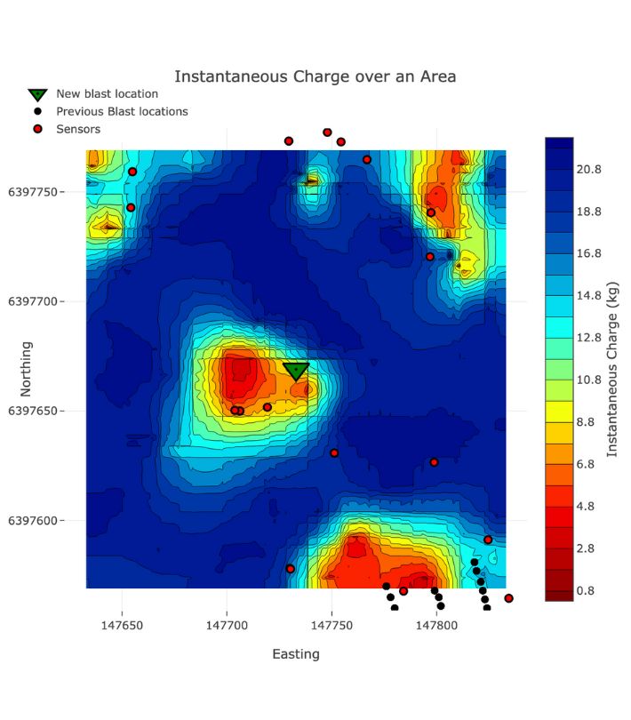
The core of the solution lies in its ability to analyse vast datasets, comprising historical blast and vibration parameters, to generate optimized blast plans with corresponding site velocity limits, aiming at reducing the risk of damage with improved precision, and enhancing operational efficiency. The AI model accounts for numerous variables, including geology, blast geometry, environmental constraints, and safety thresholds, enabling decision-making that is both rapid and evidence-based.
RiskAI offers:
- Velocity prediction and early-warning indicators when expected ground vibrations exceed project safety thresholds.
- Dynamic charge load maps, generated per blast and across entire projects, giving engineers actionable visual insights for precise drilling and charging.
- Integrated vibration risk assessment, enabling mitigation planning before any physical activity begins.
- Scenario simulation, allowing teams to test blast variations virtually and select the most cost- and risk-effective option.
- Automated parameter tracking, ensures that all adjustments are captured and linked to model recalculations in real time, enhancing both traceability and quality control.
Importantly, RiskAI Blast acts as a digital knowledge layer, capturing and encoding the experience of expert blasters and engineers into a scalable, intelligent system. This reduces reliance on manual expertise and supports knowledge transfer across teams and generations. The tool adapts continuously as it ingests more data, meaning its recommendations become more accurate and site-specific over time.

900
Estimated cost savings in a 2.5 billion SEK tunnel project.
35
Average time and cost savings enabled through AI-driven optimization.
48
Estimated tunnel blasting cost reduction when comparing RiskAI vs traditional methods.
Built for collaboration, evolving for scale
RiskAI Blast originated from a mining-induced seismic hazards research and development approach but evolved into a general-purpose tool for civil infrastructure projects, driven by demand from public and private stakeholders.
The platform supports collaborative design, automated documentation, and blast plan visualization, giving everyone from engineers to clients a shared understanding of risks and savings.
Next versions will expand capabilities into displacement, acceleration, frequency, and geospatial visualization.
.jpg)


.jpg)
Stay updated
Join our newsletter for updates, insights, and the latest news from RiskAI Blast.