Terra Eye
End costly surprises in groundworks.
Every infrastructure project begins with a risk: the ground hides what we cannot see. Buried utilities, forgotten infrastructure, or unknown obstacles can stop progress, inflate budgets, and jeopardize safety. Terra Eye was created to change that reality. By combining ground-penetrating radar surveys with existing geodata in one collaborative platform, it helps project teams minimize uncertainty, make informed decisions, and build with confidence.
The challenge beneath the surface.
Even with the best plans, surprises underground remain one of the biggest threats to efficient and sustainable construction. Traditional records are often incomplete or outdated, leaving engineers to rely on assumptions. When a pipe is hit or a cable is cut, the consequences can be severe: halted machines, emergency repairs, and risks to both workers and the environment.
For planners, the lack of reliable underground knowledge creates uncertainty in design. For contractors, it increases the risk of downtime and costly mistakes. And for cities, it raises the likelihood of unnecessary disruption to communities. To plan and build safely, we need more than assumptions—we need visibility.
Making the invisible visible.
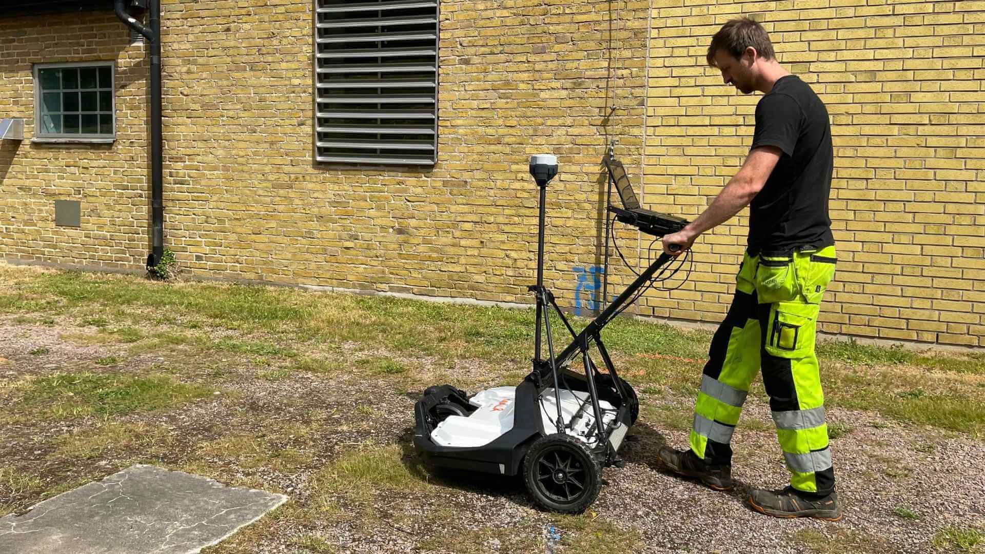
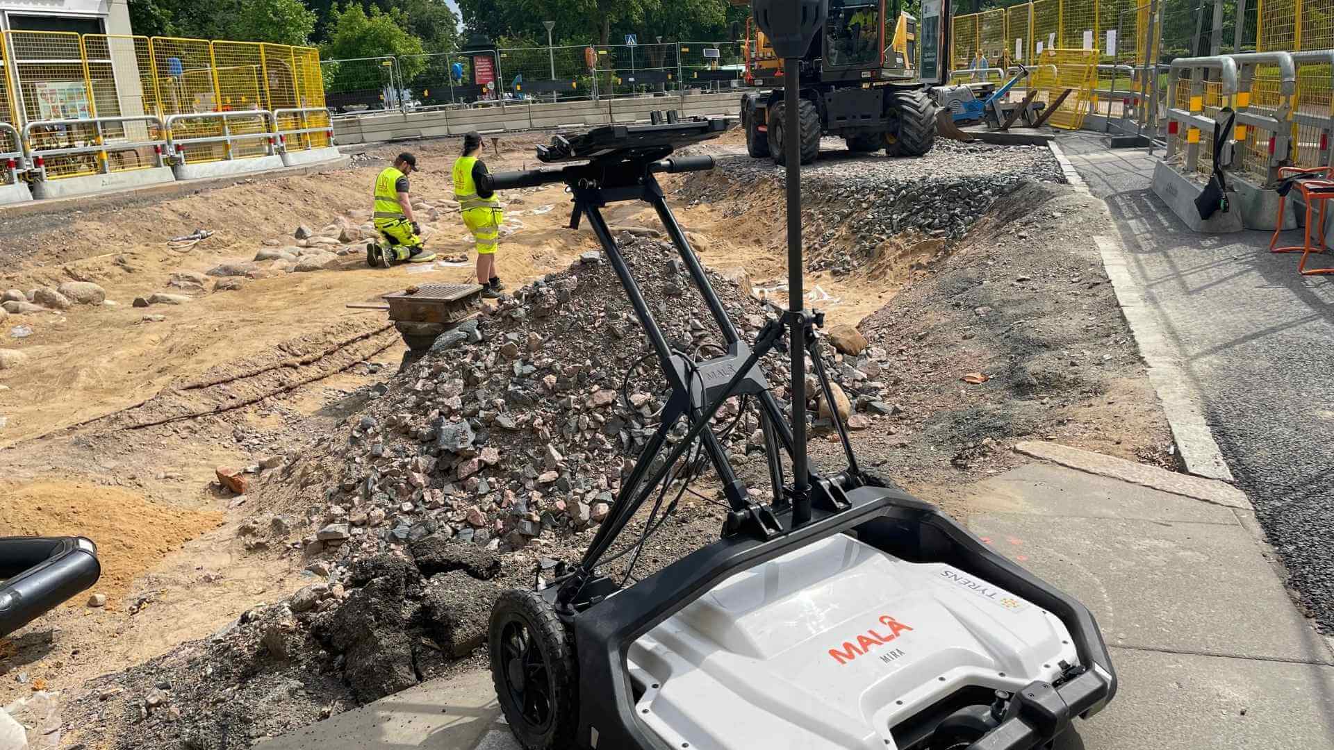
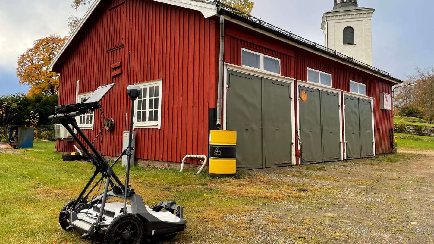
Terra Eye turns hidden risks into actionable knowledge. The platform merges existing data with the results of high-resolution 3D ground-penetrating radar surveys. The process begins with Terra Eye GPR, where field teams capture subsurface data using advanced radar systems with up to thirty channels and centimeter-level positioning. These measurements are then interpreted and co-reported alongside existing utility records inside Terra Eye Model, where they are visualized in 3D.
The outcome is a consolidated, interactive model that shows where underground objects are likely to be and where no infrastructure has been detected. Engineers can explore this information in Terra Eye Model, either on desktop or mobile, and share it directly through ArcGIS Online in Teams. To ensure practical usability, interpreted objects are also delivered in standard file formats such as DWG and SHP, complete with uncertainty estimates based on antenna frequency, soil conditions, and measurement precision.
%20(1).jpg)
From planning to execution.
Terra Eye is more than a detection tool—it is a decision-support system. For designers, it provides a reliable foundation for drawings and detailed planning. For contractors, it reduces the risk of downtime and makes excavation safer by highlighting conflicts before the first machine arrives on site. And for clients, it ensures that projects move forward with fewer unexpected costs and a lower environmental footprint.
The platform also supports direct export to machine-control systems through Terra Eye MC, meaning the insights gained in early planning extend all the way to execution. By integrating into existing digital workflows, Terra Eye makes uncertainty visible and manageable, instead of a hidden threat.
Visualize your project in 3D.
Terra Eye Model brings all existing and newly collected data together in one place. The module creates a 3D map where planners and engineers can explore underground conditions with clarity, directly connected to design tools used in the project
Detect what’s hidden below.
Terra Eye GPR delivers a complete ground survey using high-resolution 3D radar. It identifies and verifies buried utilities and other objects, with results interpreted and integrated directly into Terra Eye Model for visualization.
Build with precision.
Terra Eye MC transforms insights into action. Data from Terra Eye can be exported as machine-control files, giving contractors accurate instructions for safer and more efficient excavation.
.png)

.png)
Stay updated
Join our newsletter for updates, insights, and the latest news from Terra Eye.